
Nijagal Betta, also called Siddara Betta, shelters both a Shiva cave temple and two active dargahs within the ruins of a hilltop fort — an uncommon coexistence that draws devotees from both faiths on festival days. The fort retains ruined walls, a deteriorated mantapa, and an older temple with a fig tree growing through its structure. The approach follows a clear path past the Anajanya temple on the lower slopes, climbing through scrub to a first-level plateau before the final ascent. The summit is reached by a rock scramble; the rock face is slippery after rain. The summit boulders form an irregular natural theatre of balanced granite, with views toward Shivagange hill to the south and the Dobbaspet plains below. Kites are commonly seen riding thermals above the ridge.

Chamundi Betta is a 1062-metre hill above Mysuru, revered as the seat of Goddess Chamundeshwari, the tutelary deity of the Wadiyar dynasty. The trek follows 1008 stone steps cut into the hillside, a pilgrimage route in continuous use for several centuries. Midway at around step 800, a Nandi bull carved from a single granite block in 1659 CE by Dodda Devaraja Wadiyar stands 4.9 metres high, among the largest monolithic Nandi statues in India. The steps are broad and well-maintained throughout, passing through dry deciduous scrub with occasional fig trees rooted in the rock face. The summit temple complex includes the Chamundeshwari shrine and a 40-metre gopuram, with older subsidiary shrines inside the compound. From the top, Mysuru spreads below: the Amba Vilas Palace is clearly identifiable, and on a clear day the hills fringing Bandipur are visible to the south. The trail is entirely on marked stone steps with no route-finding; the main variables are crowd level, which peaks sharply on weekends and during Dasara, and heat on the exposed lower section.

The Brahmagiri route from Thirunelli crosses two distinct ecological zones in a single climb: moist deciduous forest with confirmed tiger and leopard activity in the lower section gives way, at the watch tower, to open highland grassland where elephants and deer are visible across unobstructed slopes. The approach from the Thirunelli Eco Tourism centre follows a broad jeep track through forest with multiple stream crossings before reaching the multi-storey watch tower that looks back over Thirunelli village. Above the tower the forest disappears entirely, the leech load drops sharply, and the route continues through grassland over several false summits to the main peak on the Kerala-Karnataka border. The fire line marking the state boundary is visible from the upper trail. Malabar giant squirrels and Nilgiri Langur are seen in the forest canopy on the lower trail. The forest section carries a heavy leech load during and after the monsoon.

Ramadevara Betta is India's first vulture sanctuary and the filming location for the 1975 Hindi film Sholay, set in the granite hills near Ramanagara. The 346-hectare sanctuary was formally declared in 2012 under the Wildlife (Protection) Act, though the area had been reserved since 1917 under the Maharaja of Mysore State. The marked trail begins with stone steps and divides naturally into two sections: trailhead to the Ram temple, with smaller shrines lining the approach and a pond alongside the temple; and Ram temple to the summit. At the Ram temple the trail forks: one branch leads to Sri Kote Anjaneya Gudi, the other to the peak. The final ascent crosses a granite rock wall with steps cut into the face and metal railings along the exposed section. The summit is a flat granite platform with unobstructed views of the surrounding hills on all sides.

Bairaveshwara Betta is a steep hillside trail near the village of Annahalli, in Ramnagara district. The hill takes its name from the Bairaveshwara temple that sits roughly three-quarters of the way to the top. The climb rises sharply from the base with no gradual opening; iron railings fixed by villagers line the steepest sections and are in regular use even in dry conditions. A small pond with white lotus flowers sits roughly halfway up and marks a natural rest point. The temple is where most hikers stop; the trail continues past it to a grass-covered top with views of the surrounding hills. Annahalli Lake lies at the base of the hill and is visible from the upper sections of the climb. The exposed rock surface turns slippery after rain, and the gradient makes the railings necessary rather than optional on wet days.

Gangadikallu is a 1,465-metre summit in Kudremukh National Park, reached by a shola forest trail with a steep zigzag final climb to an open ridge. The trailhead sits at a forest checkpost roughly 8 kilometres from the Kudremukh Forest Office, where permits are verified and guides assigned before entry.

Bilikal Rangaswamy Betta is a forested granite hill named for the pale granite exposed at its summit: "bilikal" means white rock in Kannada. A Ranganathaswamy (Perumal) temple sits at the top, built against a large granite boulder, and draws pilgrims on Saturdays. Two routes reach the summit: a jeep track controlled by a Karnataka Forest Department checkpost, and a walking trail through the same protected forest. The walking trail climbs through tamarind-shaded farmland before entering dry deciduous forest. A wildlife trench marks the sanctuary boundary: a deep concrete ditch built to limit elephant movement into surrounding farmland. From that point onward, elephant dung is commonly found along the trail. The trek route carries no formal checkpost, but it runs through a wildlife corridor in restricted forest. The final section is steep, on loose rock, and slippery after rain.

Deep in the wilderness of the Kudremukh range, the trail to Kurinjal Peak is a beautiful mix of adventure and changing landscapes. The trek begins along rocky forest paths before reaching the Bhadra River, with river crossings and a rustic bridge adding to the experience. Beyond the river, the trail winds through dense, mist-covered forests, surrounded by the lush greenery and quiet wilderness of the Western Ghats.
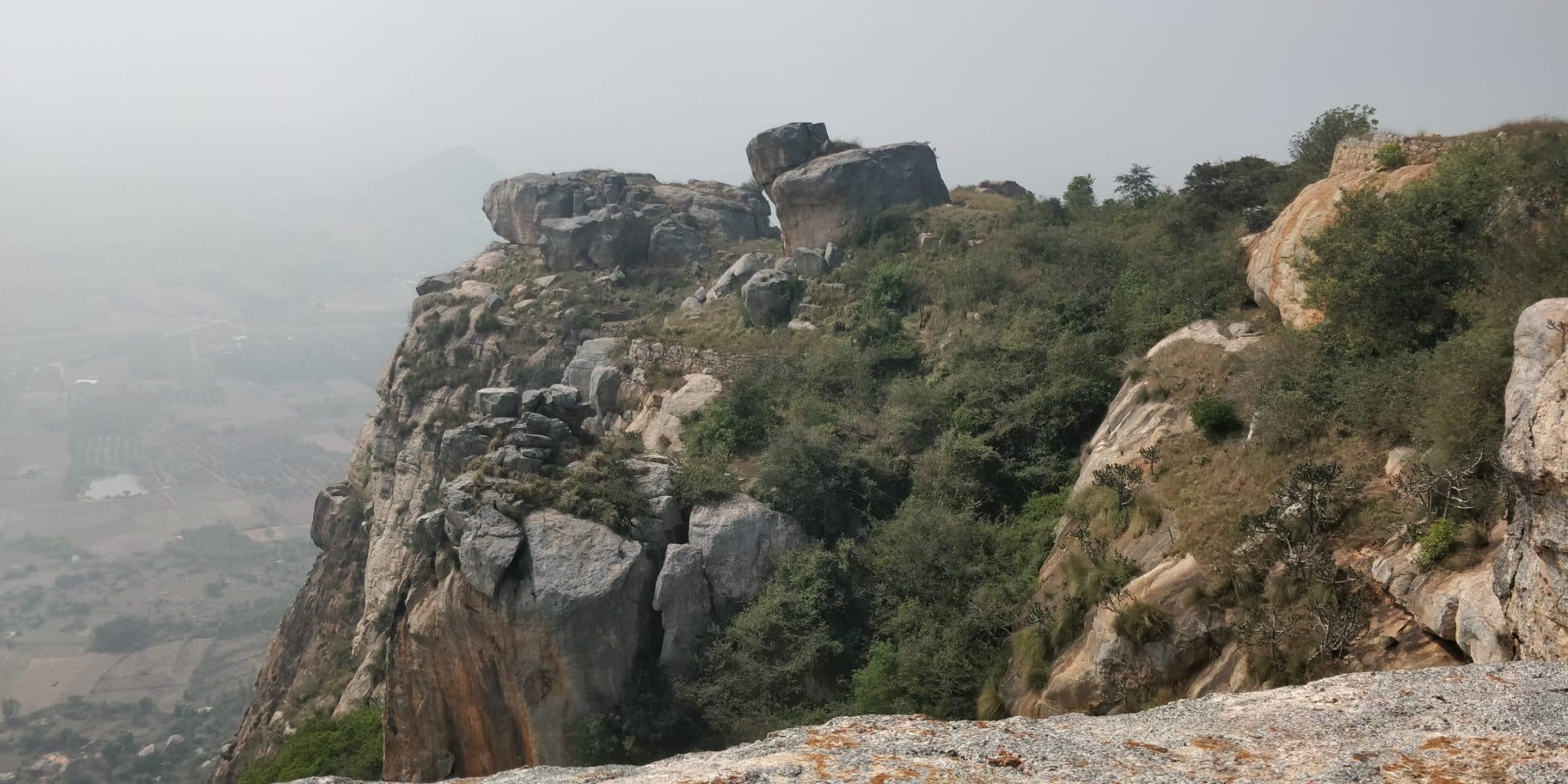
Kaiwara Betta is a granite hill above the pilgrimage town of Kaiwara in Chikkaballapur, managed under Karnataka Ecotourism. Kaiwara is a long-standing Vaishnava pilgrimage site: its temples are linked to the Prahlada legend from the Bhagavata Purana. The hill reportedly carries a shrine at the top, drawing pilgrims alongside trekkers.