About this trail#
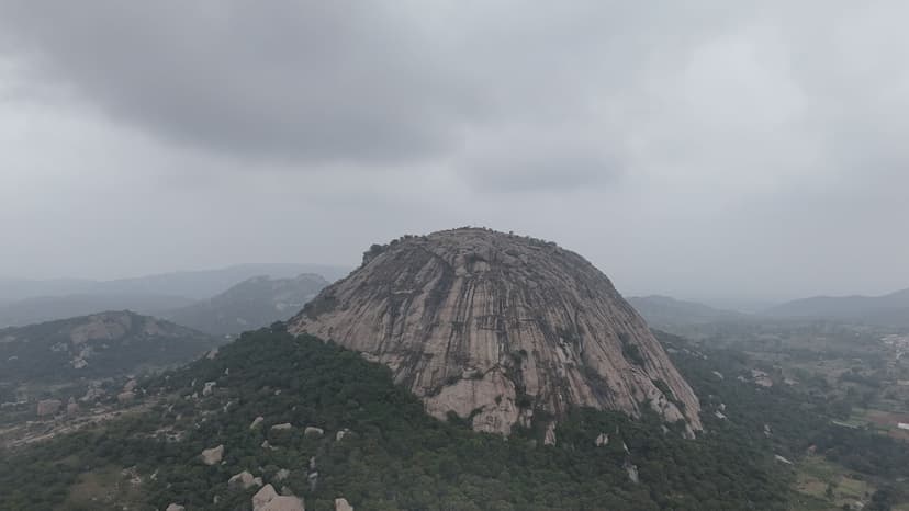
Devarabetta is a granite monolith on the Karnataka-Tamil Nadu border, its base enclosed by the Shri Rudra Muneshwara Swamy Temple and its summit reached by a stairway. The hill's name translates to "God's Hill" in Kannada. The monolith is one of several isolated granite outcrops in this part of the Deccan, rising abruptly from the surrounding plateau. The stairway ascends the rock face from the base of the rock, gaining 65 metres to the Sri Malleswara Swami Gudi shrine at the highest point. The hill sits at the forest edge: the canopy extends beyond the summit, and the small access village is visible in the foreground from the top. The approach road through the village carries no signboards: the temple compound at the base of the rock is the only landmark to navigate by. The area lies within the wildlife corridor linking Bannerghatta to the Cauvery basin; elephant movement through the surrounding forest is periodically reported.
Trail Information#
Temple to Stairway Base
From the temple, a short path of roughly 100 metres leads to the base of the stairway on the rock face.
Stairway
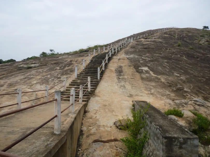
Concrete stairs with railings ascend the granite face in roughly 100 steps to the summit. The railings run the full length of the climb.
Summit
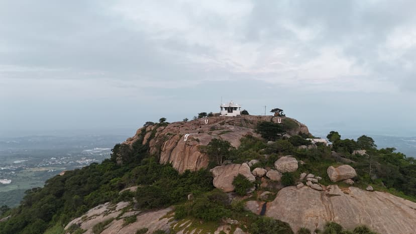
The stairway ends at Sri Malleswara Swami Gudi, a small shrine at the highest point. The hill marks the forest edge: the canopy extends beyond the summit, and the access village is laid out clearly below.
Getting there#
Trail route
Route flyby#
Preview the terrain before you go — a 3D fly-through of the full route.
Trail reports#
Trail conditions and experiences shared by hikers who've done this route
No trail reports yet
Be the first to share current conditions — trail state, crowd levels, water availability, or anything others should know before going.
GPX file#
Download the GPX route to use with your GPS device or hiking app. Learn how to use GPX files. To protect our trail data from bulk harvesting, downloads are limited to one per account per week.
Sign in to download
Create a free account to download the GPX file and use it with your GPS device or hiking app.
Wildlife & Nature#
The area falls within the corridor between Bannerghatta National Park and the Cauvery basin. No sightings have been confirmed on the hill itself, which is close to the village, but the surrounding scrub and forest is active elephant habitat.