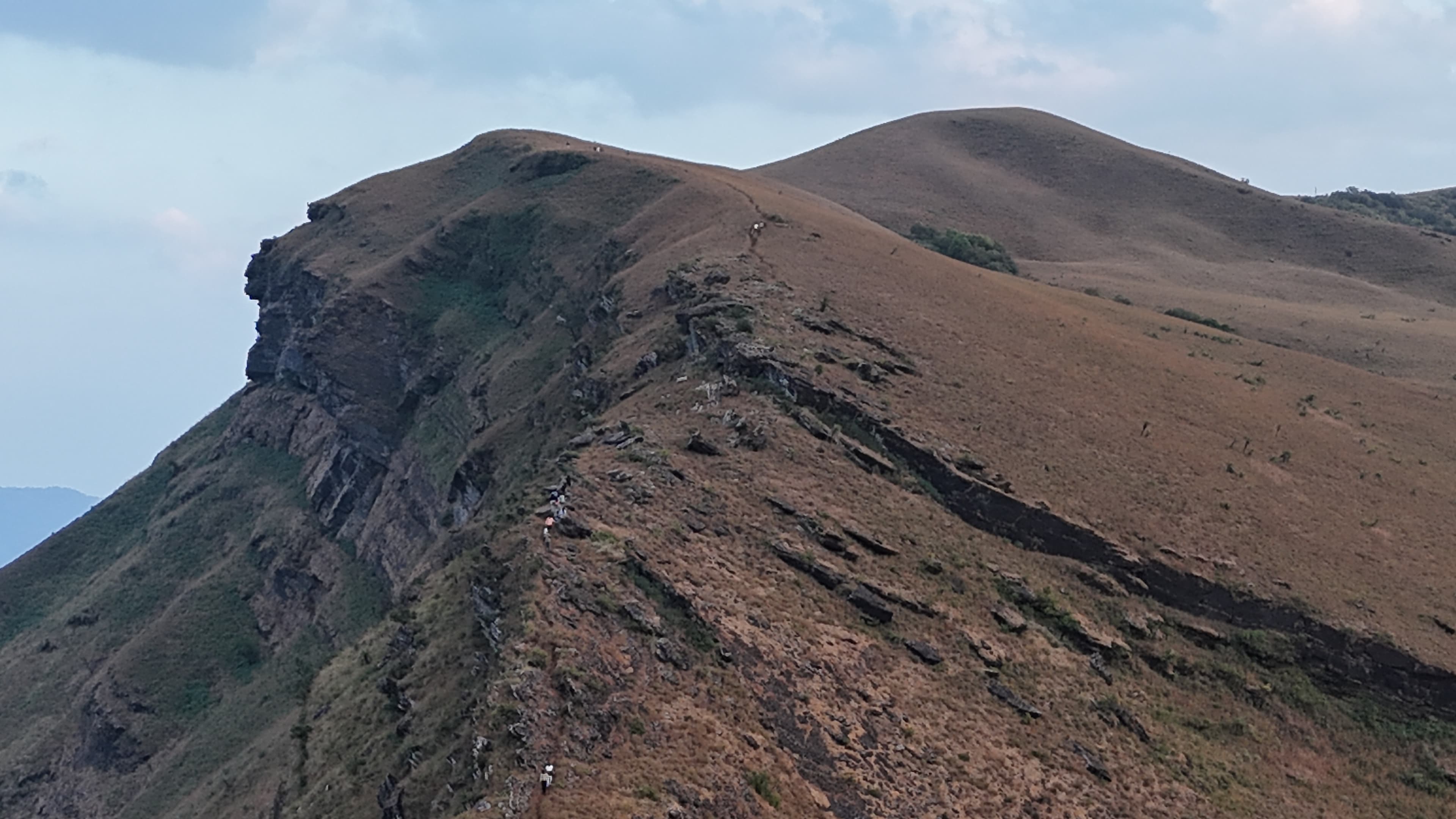

We visited the trail as summer was approaching, and the seasonal change in the grasslands was clearly visible. The lush green cover seen after the monsoon had largely disappeared, with the landscape transitioning to shades of golden yellow as the grasses dried. Strong winds were present at Z Point, making it one of the windiest sections of the hike during our visit. Apart from these seasonal conditions, the trail remained in good condition and the hike proceeded without any significant obstacles.
Distance
4.92 km
Elevation gain
110 m
Route type
out-and-back
About this trail#
The trail showcases the characteristic montane grasslands of the Western Ghats, particularly during the monsoon and post-monsoon seasons when the hills turn green. The route begins in dense forest before emerging onto open grassy slopes that overlook the surrounding valleys. Early mornings often bring low-lying fog that fills the valleys, creating changing views as the sun rises. The hike ends at Z Point, a prominent viewpoint along the escarpment, while the mountain's true summit remains within a restricted area and is not accessible via the permitted trail. The well-defined path and gradual terrain make this trail suitable for families with children.
Trail Information#
The trail begins at the forest checkpost, where visitors must pay the entry fee before starting the hike. The initial section follows a broad jeep track through dense forest with mature trees providing continuous shade.
After some distance, the route narrows into a footpath that traverses the mountainside. This section leads to Shanti Falls, a seasonal stream that may be dry outside the monsoon and post-monsoon months. Beyond the falls, the landscape opens into rolling grasslands as the forest gradually gives way to open slopes. The trail continues along the edge of the mountain with increasingly open views before reaching Z Point, the end of the legally permitted route.
A separate trail branches off much earlier toward the mountain's highest peak. Although this route exists, it leads into a restricted area and is not open to visitors. Z Point is therefore the final destination for hikers using the authorized trail.
Getting there#
Trail route
Route flyby#
Preview the terrain before you go — a 3D fly-through of the full route.
Trail reports#
Trail conditions and experiences shared by hikers who've done this route
GPX file#
Download the GPX route to use with your GPS device or hiking app. Learn how to use GPX files. To protect our trail data from bulk harvesting, downloads are limited to one per account per week.
🗺️
Sign in to download
Create a free account to download the GPX file and use it with your GPS device or hiking app.
Wildlife & Nature#
Wildlife activity is limited due to the trail's popularity and high visitor footfall. During our visit, we did not observe signs of large wildlife. However, the trail had abundant bird activity in the morning, with birds frequently seen and heard throughout the hike.
Camping#
Camping is not allowed on this trail.

