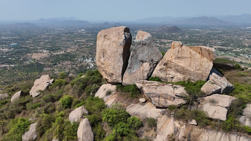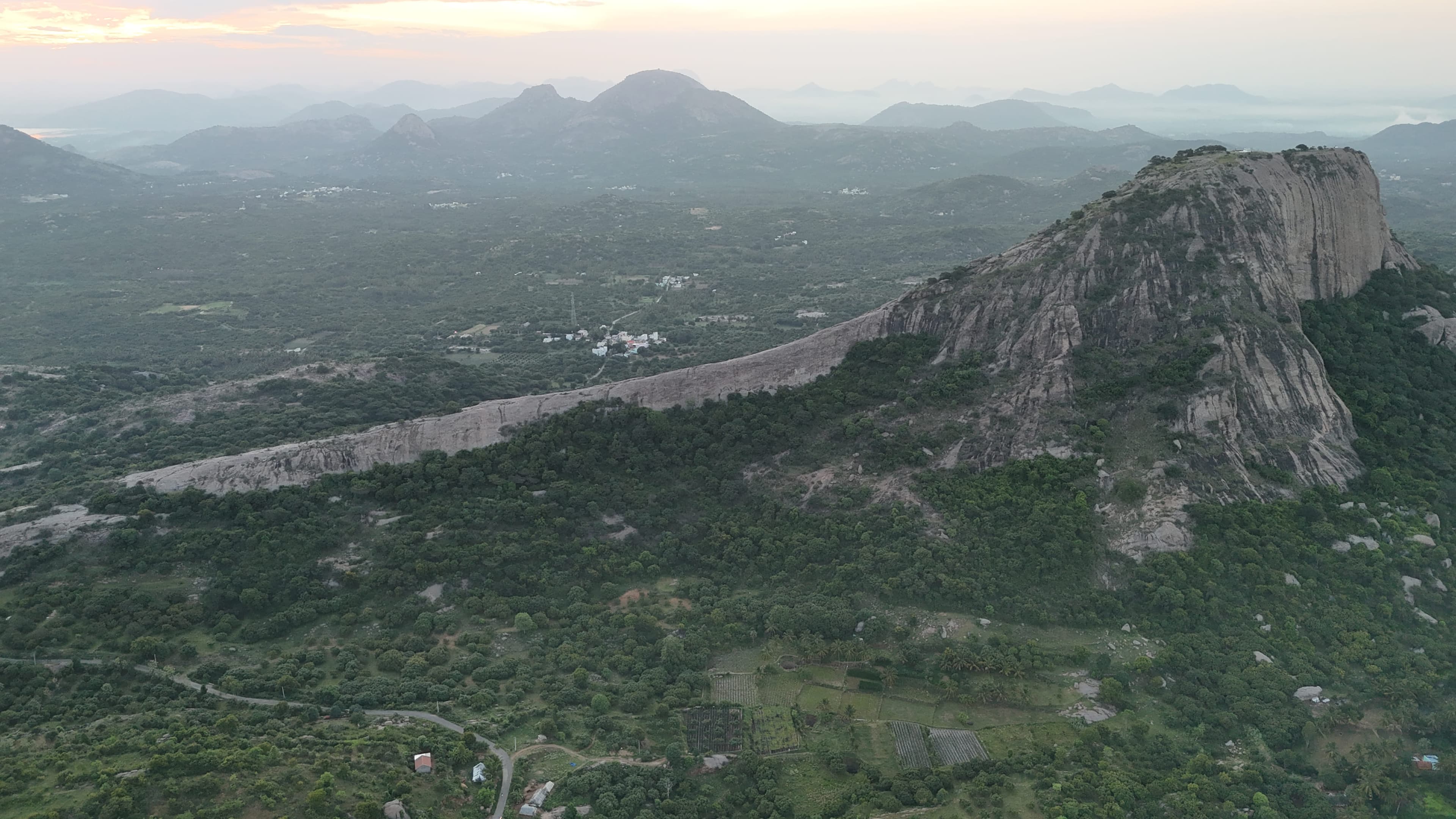

Bangalore traffic pushed our arrival past sunset, so we started the climb in the dark with headlamps. The sounds of loudspeakers and passing vehicles from nearby villages drifted up through most of the ascent. We were the only people on the trail. There is no water source at the summit, so we carried everything up. The extra weight tells. I made the mistake of hand-carrying a 5-litre bottle rather than packing it, and the handle cut into my palm badly enough to draw blood before we reached the top. We found a flat patch near the summit and pitched the tent by torchlight. By the time we finished our packed dinner, the village lights had mostly gone dark. Then a lightning storm started somewhere to the southwest, playing out silently across the horizon for the better part of an hour. The winds picked up steadily through the night, loud against the tent. At some point a recurring sound, somewhere between a large bird and wind pulling through the rocks, kept breaking the quiet. The morning settled everything. We caught the full sunrise from the summit, had coffee and Maggi on the peak, and stayed until the heat off the granite made sitting uncomfortable. Third time on this trail, first time camping. It changes the place considerably.
About this trail#
Machakal is a rewarding hill trek featuring a scenic ridge walk and expansive views of the surrounding countryside. The trail gradually climbs through rocky terrain before reaching the summit, where the Machakal Thimmaraya Samy Temple sits atop the hill. Along the way, hikers can spot remnants of old fortifications, hinting at the historical significance of the peak. During mango season, the orchards around the hill are laden with fruit, adding vibrant shades of green and yellow to the landscape. The combination of a beautiful ridgeline, seasonal mango orchards, historic ruins, and a hilltop temple makes Machakal a memorable hike for those exploring the lesser-known hills around Bengaluru.
Trail Information#
Parking to the Ridge
The trail begins from the parking area with a steady climb up the side of the ridge to reach the main ridgeline. Much of the ascent follows rock-cut steps before passing a small idol where local villagers perform puja. Beyond the idol, the trail becomes steeper with a few rocky sections that require short scrambles before easing onto the crest of the ridge. Once you reach the top, the summit and the remaining route become clearly visible.
Ridge Walk
From the ridge, the trail follows the backbone of the hill towards the summit. This section covers most of the trail's distance while gaining relatively little elevation. The exposed ridgeline is almost always windy and offers uninterrupted views on both sides before leading towards the final climb.
Ridge to the Gateway
Near the end of the ridge, the trail turns right and begins a sustained ascent. Ruined fortification walls appear along this section, indicating the hill's historical significance. The climb becomes noticeably steeper before reaching two stone pillars that form a gateway to the final section of the trail.
Gateway to the Summit
Beyond the stone gateway, the trail climbs steeply over rock to the summit temple. The rocky area beyond the temple can also be explored, where additional viewpoints and further remnants of the hilltop fortifications can be found.
Getting there#
Trail route
Route flyby#
Preview the terrain before you go — a 3D fly-through of the full route.
Trail reports#
Trail conditions and experiences shared by hikers who've done this route
Late March, and the trail was empty from start to finish. That is typical for peaks in this part of Tamil Nadu. At the summit, a bird we didn't recognise at first moved fast enough that we almost missed it. Not the wide, soaring circles of a black kite or brahminy kite. This one cut and changed direction at a speed those birds don't have. We ran it through Merlin: a falcon. The drone footage from the ridge put the scale of the climb in perspective. On the screen, we looked like two dots on a rock face. The visibility was good enough to pick out Bolumalai and the Krishnagiri dam, and several other peaks in the surrounding range that are now on the list.
GPX file#
Download the GPX route to use with your GPS device or hiking app. Learn how to use GPX files. To protect our trail data from bulk harvesting, downloads are limited to one per account per week.
Sign in to download
Create a free account to download the GPX file and use it with your GPS device or hiking app.
Wildlife & Nature#
Rabbit droppings can often be seen along parts of the trail, indicating the presence of wild rabbits in the area. The hills are also home to junglefowl, which are occasionally spotted or heard in the surrounding scrub. Birdwatchers may be fortunate enough to spot a peregrine falcon, the world's fastest bird, soaring above the rocky cliffs.
Camping#
We camped at this trail and found reasonably flat ground suitable for pitching tents. During our visit, we did not observe any signs of large wildlife activity, making the campsite suitable based on our observations. There is no reliable natural water source near the camping area. Night-time conditions were quiet, with minimal noise and relatively low light pollution, providing a suitable environment for overnight camping.